


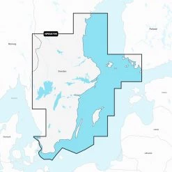
Navionics Platinum Caribbean CF Chart Card
Original price was: £403.00.£92.99Current price is: £92.99.
- Protect Your Wallet with Safe Payments
- 100% High Quality Guarantee
- Buy with confidence, backed by quality.
- We take quality seriously.


Bring the ocean floor to life!
The award winning Navionics Platinum Chart Card
comes packed with the best cruising features available for your
chartplotter! Boasting its excellent cartography and an extensive
photo library, this multi-dimensional marine chart offers
navigators and fishermen a wide selection of bonus information that
goes well beyond the available navigation charts today. It features
panoramic pictures, 3D/2D views with satellite imagery, coast pilot
guide, POI and a built-in offshore fishing detail. Navionics uses
the largest scale charts available to provide accuracy and the best
details of a given area.
Navionics Platinum Chart Card Features:
- Chard card for the Caribbean
- Seamless chart details
- View depths and elevations in 3D
- Photo overlay allows comparison with chart information thus
improving situation awareness - Improve your approach with over 15,000 photos of harbours and
marinas - Detailed information; including phone numbers for port services
and points of interest - Geo-referenced coast pilot automatically displays the paragraph
pertaining to a selected marina - CF Chart Card format
Compatible Models For: Navionics Platinum Plus CF Chart
Card:
- Raymarine: G-Series G120, G150, G170, G190,
GPM400; E-Series Widescreen E140W, E120W, E90W; C-Series Widescreen
C140W, C120W, C90W; A-Series 70, 70D, 57, 57D, 50, 50D
What happens if your Model of GPS is not on the list
above? Most likely this is the wrong chart for your
machine! So try looking through our range of other GPS
Charts to find the correct card for your unit. Or you can also
check the Navionics website for the latest
Compatibility Guides
Be the first to review “Navionics Platinum Caribbean CF Chart Card”
Related products

Reviews
There are no reviews yet.