


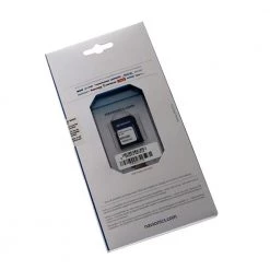
Navionics Plus 43XG Mediterranean And Black Sea CF Chart Card
Original price was: £299.00.£93.99Current price is: £93.99.
- Protect Your Wallet with Safe Payments
- 100% High Quality Guarantee
- Buy with confidence, backed by quality.
- We take quality seriously.


Now with SonarChart!
Whether you’re on the water or planning a trip, Navionics Plus
charts can take you there! The Navionics Plus Chart
Card is a 2-dimensional marine chart that’s considered to
be the navigation standard for serious mariners and fishermen. Now
with SonarChart, this chart lets you see extraordinary bottom
contour detail, great for increasing awareness of shallow waters
and for locating fishing areas at any depth level. You can also
switch to the standard Nautical chart appearance by simply pressing
1 button. The Navionics Plus provides superior detail, shaded depth
contours, real-world shapes, colours for buoys and navaids, tide
and current data, spot soundings and many more. It’s your ultimate
companion and navigator across the seas.
Just plug and play into a Navionics compatible plotter and have
easy access to all the essential information found on official
paper charts and fishing maps. These Navionics charts provide
navigators and fishermen all the necessary data for safer and
easier navigation.
SonarChart
SonarChart is an HD bathymetry map featuring extraordinary bottom
contour detail, great for increasing awareness of shallow waters
and for locating fishing areas at any depth level.
1 ft/0.5 m HD bathymetry
Enjoy the exclusive SonarChart layer with up to 1 ft/0.5 m
contours. Upload your sonar logs to build even better local charts
for your area. You can do it with your plotter or use your mobile
device connected wirelessly to your sounder with SonarChart
Live.
Worldwide Regions
Navionics+ is a versatile and innovative product. Preloaded regions
are ready to use, while the downloadable Global Regions version
lets you choose your coverage area during activation. Both allow
you to download and update the marine and lakes content and chart
layers you want with great flexibility.
Navionics Plus Chart Card Features:
- Nautical Chart, SonarChart and Community Edits in one
card - High definition layer
- Take advantage of daily updates
- Format: CF Card
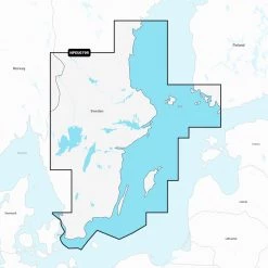
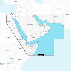
- Coverage: Mediterranean and Black Sea
Compatible Models For: Navionics Plus CF Chart
Card:
- Raymarine: G-Series G120, G150, G170, G190,
GPM400; E-Series Widescreen E140W, E120W, E90W; C-Series Widescreen
C140W, C120W, C90W; A-Series 70, 70D, 57, 57D, 50, 50D - geonav: 11 C Net; 11 C; 7 Wide, Wide Net; 5
Touring; 4 Gipsy, Gipsy NMEA; Multy; 11 Flash, Sun, Sunshine; 10 C;
8 Sunshine; 7 C; 6 Sun, Sunshine; 5 C; 4 CXS, C - Northstar: 6100i (requires S/W update 7.76);
6000i
What happens if your Model of GPS is not on the list
above? Most likely this is the wrong chart for your
machine! So try looking through our range of other GPS
Charts to find the correct card for your unit. Or you can also
check the Navionics website for the latest
Compatibility Guides
Be the first to review “Navionics Plus 43XG Mediterranean And Black Sea CF Chart Card”
Related products


Reviews
There are no reviews yet.