


-31%

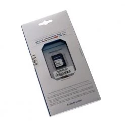
Navionics Silver US Lakes Rivers And Coast Chart SD/MSD For Raymarine
Original price was: £99.00.£68.31Current price is: £68.31.
- Protect Your Wallet with Safe Payments
- 100% High Quality Guarantee
- Buy with confidence, backed by quality.
- We take quality seriously.


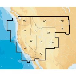
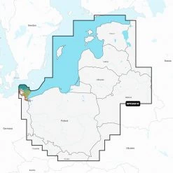
Brings the ocean floor to life!
The Navionics US Lakes Rivers and Coast Chart is
designed to be preloaded in some Chart Plotters to provide
out-of-the-box navigational safety with an enhanced basemap. Silver
includes coastlines, drying lines, all navigation aids, and depth
information up to 10 metres (30 feet). Plus, you can get other
information as recommended by international standards for safe
navigation with a simplified, uncluttered chart.
Navionics US Lakes Rivers and Coast Chart
Features:
- Seamless chart details
- Format: SD/MSD
- Shows Nav-aids
- Shaded Contours
- Spot Soundings out to 10 metres
- No Clutter
- No Holes
- No Discontinuities
- Compatible units: G-Series GPM400; E-Series Widescreen E140W,
E120W, E90W; E-Series E120, E80; C-Series Widescreen C140W, C120W,
C90W; A-Series A70D, A70, A57D , A50, A50D C-Series C120, C80, C70;
RC 435, 435I, 400
Be the first to review “Navionics Silver US Lakes Rivers And Coast Chart SD/MSD For Raymarine”
Related products
-81%
Original price was: £509.00.£95.99Current price is: £95.99.
-65%

Original price was: £269.00.£92.99Current price is: £92.99.
-65%
Original price was: £269.00.£92.99Current price is: £92.99.
-62%
Original price was: £239.00.£91.99Current price is: £91.99.
-78%
Original price was: £419.00.£92.99Current price is: £92.99.
-74%

Original price was: £349.00.£91.99Current price is: £91.99.
-64%
Original price was: £269.00.£97.99Current price is: £97.99.
-78%

Original price was: £419.00.£93.99Current price is: £93.99.
Reviews
There are no reviews yet.